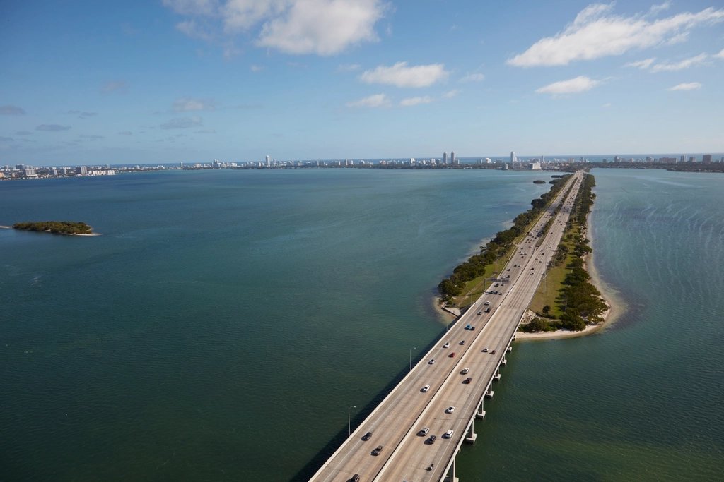
Melbourne makes more sense once you understand its roads and waterways. The mainland, Indian River Lagoon, and beachside communities create a travel pattern that can be unfamiliar to newcomers.
A home near the beach, a job near the airport, and a favorite restaurant in Eau Gallie may all be described as “Melbourne area.” They still involve different routes.
This guide explains the connections to learn first, with extra attention to Lake Washington, Wickham Road, Eau Gallie, and West Melbourne. Official resources were reviewed October 5, 2026. Travel times, roadworks, flight schedules, and bus service should be checked for the day you travel.
Key takeaways
- Three causeways (Eau Gallie, Melbourne, and Pineda) connect the mainland to the beachside communities.
- Key I-95 exits: 180 (U.S. 192), 183 (Eau Gallie Boulevard), 188 (Pineda Causeway), and 191 (Wickham Road).
- MLB and MCO are different airports. Confirm the airport code on your booking.
- Use FL511 for today’s traffic and test your commute at your normal travel time.
Mainland and Beachside Are Different Travel Areas
Much of Melbourne is on the mainland, west of the Indian River Lagoon. Indialantic, Indian Harbour Beach, Melbourne Beach, and Satellite Beach are among the communities on the barrier island to the east.
Causeways connect these areas. For a person living mainland and working beachside, a crossing becomes part of the weekday commute. For someone who works and lives mainland, it may be mainly part of a beach outing.
Choose your route using the actual destination, rather than treating “the beach” or “Melbourne” as one map pin.
The Main Roads to Learn First
| Road | How to think about it | What to check |
|---|---|---|
| Wickham Road | A major mainland corridor connecting many everyday destinations. | The exact address; the corridor is long. |
| Lake Washington Road | A local connection for the Lake Washington area. | Your turns, crossings, and route to other main roads. |
| Eau Gallie Boulevard / S.R. 518 | An east-west connection through the Eau Gallie area. | Route continuity toward the interstate or causeway. |
| U.S. 1 | A north-south mainland corridor nearer the lagoon. | Intersections and access to the specific destination. |
| U.S. 192 / New Haven Avenue | An east-west corridor through the Melbourne/West Melbourne area. | Store entrances, downtown approaches, and causeway route. |
| Interstate 95 | A regional north-south route west of many local destinations. | The entrance and exit that suit the entire journey. |
| S.R. A1A | A north-south beachside route. | The beach access or destination you actually want. |
A road’s familiar name may change along a journey. Let navigation help you learn the route, while paying attention to posted signs and the destination entrance.
Causeways Between the Mainland and the Beaches
Eau Gallie Causeway
The Eau Gallie Causeway is an important mainland-to-beachside connection in the northern part of the Melbourne area.
For people exploring Lake Washington, Wickham Road, or Eau Gallie, it is one route to consider for destinations around Indian Harbour Beach and nearby beachside areas.
That does not make it the best route for every trip. Compare the current route to your actual destination, including the final approach and parking.
Melbourne Causeway
The Melbourne Causeway connects the downtown side of Melbourne with the Indialantic area via the U.S. 192 corridor.
It is useful to understand if your plans include Downtown Melbourne, Indialantic, or destinations farther south along the barrier island.
A causeway crossing does not finish the trip. Account for the road you will use afterward and whether your destination is north or south of the crossing.
Pineda Causeway
Pineda Causeway, S.R. 404, provides another connection farther north, including access toward the beachside and I-95.
It may be relevant when comparing northern destinations or alternate routes. Avoid assuming that the nearest-looking crossing on a map will always produce the best trip; check the complete journey.
I-95 Exits Worth Recognizing
The Florida Department of Transportation exit directory identifies several useful local connections:
| Exit | Connecting road |
|---|---|
| 180 | U.S. 192 |
| 182 | Ellis Road |
| 183 | S.R. 518 / Eau Gallie Boulevard |
| 188 | S.R. 404 / Pineda Causeway |
| 191 | Wickham Road |
| 193 | Viera Boulevard |
These are orientation points, not directions from a specific apartment. Choose the exit based on the destination and current route conditions.
What to Check From Lake Washington and Wickham Road
Begin with your most frequent destinations: work, groceries, school or childcare, and the places you visit after work.
Try the route at your normal travel time. Notice whether you need a difficult left turn, how the property entrance works, and whether another route is practical.
This part of Melbourne can be considered alongside Eau Gallie and West Melbourne in a mainland housing search. Your worksite may make one location more useful than another, even when the advertised distance looks similar.
Commutes to Aerospace, Technology, and Healthcare Employers
Large employers can have multiple campuses, buildings, or entrances. A general company search may point to a headquarters rather than the place you will report.
Before choosing where to live, ask your employer for the exact worksite and approved entry point. Include any time needed between arriving at the site and reaching your building.
Shift schedules also matter. A commute for an early start can differ from one during a typical morning peak. Compare routes for your own schedule instead of adopting a drive-time claim from a housing listing.
Test a Commute Without Inventing a Fixed Travel Time
Look at navigation estimates for several ordinary workdays and your expected departure time. Where possible, drive the route yourself.
Compare the return trip as well. Add a realistic stop for childcare, groceries, or another regular errand.
Do not turn a single quiet drive into a permanent “15-minute commute” promise. Weather, incidents, roadworks, school schedules, and events can change conditions.
Official Traffic and Construction Resources
FL511 is Florida’s official real-time traffic resource. Use it for current incidents, traffic conditions, and available camera information on covered roads.
For planned work, check FDOT’s Central Florida project website. Its project finder allows searches by road, city, or county.
These tools serve different purposes: a project page explains planned work, while real-time traffic information helps with today’s journey. Consult relevant municipal or county notices for local-road issues that may not be shown.
Can You Get Around Without a Car?
Space Coast Area Transit offers bus service and official route-planning resources. Whether it fits your routine depends on the stops, schedule, connections, and walking portions of your trip.
Use 321Transit’s rider tools to enter a starting point and destination, select the day and time, and review the route. Confirm the return journey and current service notices.
Inspect the walk to the stop, especially if it includes a busy road crossing. Do not assume a bus route near an apartment guarantees a convenient trip to your workplace.
For rideshare or taxi trips, check actual availability and cost for the time you need. A service used occasionally may not fit a daily budget.
Melbourne Airport and Orlando Airport Are Different Destinations
Melbourne Orlando International Airport uses code MLB. Orlando International Airport uses code MCO. The shared word “Orlando” can confuse newcomers, but these are different airports.
Use MLB’s official flight resources and MCO’s official website to compare flights for your actual dates.
Include the whole journey: road travel, parking or drop-off, terminal access, connections, and the return trip. Airline routes and seasonal service change, so avoid relying on an old destination list.
If someone is collecting you, send the airport code and flight information rather than just saying “Orlando.”
Walking and Cycling Need Route-Level Research
A destination can be close by car without having a comfortable walking route. Look at sidewalks, crossings, lighting, and the entrance at both ends.
For cycling, inspect the specific road or path and current conditions. Do not assume a continuous protected route because one segment has a bicycle facility.
Plan outdoor travel with heat, rain, and daylight in mind. When evaluating a home, test the routes you expect to use most often.
Choosing a Location That Fits Your Week
Getting familiar with Melbourne’s roads helps you compare homes more realistically. A location works best when it suits your ordinary travel, not just one weekend outing.
If your search includes Lake Washington and Wickham Road, explore Summerset Apartments and test your own routes from the surrounding area.
Related guides: Moving to Melbourne, FL for work, Living near Lake Washington and Wickham Road, and Moving to Melbourne, FL? What to know. You can also check current availability.
Test your commute from Lake Washington Road
Tour Summerset just off Lake Washington Road, and get a $50 move-in credit with your inquiry.
Frequently Asked Questions
Which causeway should I use?
Choose based on your starting point, final destination, and current conditions. Eau Gallie, Melbourne, and Pineda causeways serve different approaches.
Is MLB the same airport as MCO?
No. Confirm the airport code on your booking and ground-transportation plans.
Where can I check road closures?
Begin with FL511 for current traffic and FDOT’s Central Florida project site for planned work, then check local agency notices as needed.
Should I choose an apartment based only on distance to work?
No. Compare the entire route, worksite entrance, travel schedule, and regular stops.